
Browse Items (13654 total)
Sort by:
FRI Cover Type Map for Portion of Plonski (EMU) Forest
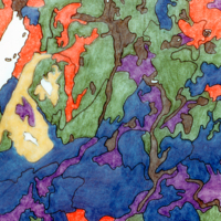
FRI cover type map for portion of Plonski (EMU) Forest for same areas covered by #307 in soil survey map.
Soil Map for Part of Plonski Forest (EMU)
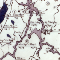
Soil map for part of Plonski Forest (EMU) in North Eastern Ontario. Mapped in 1970 as scale of 1:15,840. cf #308 for FRI of same area.
Close-up of Soil Map for Part of South Eastern Vancouver Island
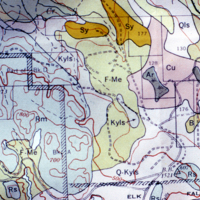
Close-up of soil map for part of South Eastern Vancouver Island cf. 305.
Portion of Soil Map for South Eastern Vancouver Island
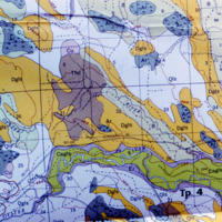
Portion of soil map for South Eastern Vancouver Island.
Orthic Ferropodzol
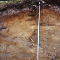
Orthic ferropodzol in windblown sand at Plonski Forest Burt Twp. N.B. perturbation of left side of Stand was fire origin jack pine.
Sol Brun Acide in Healthland Soil
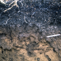
Sol brun in healthland soil that has been cultivated. N.B. the plow layer and a root channel. Near Razes.
Podzol After Disturbance
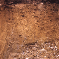
Podzol after disturbance near Poitiers. Disturbance in healthland profile from cultivation.
Orthic Humoferric Podzol
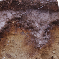
Orthic humoferric podzol in till at J.D. Irving, Black Brook. N.B. irregular Ae lower boundary.
Orthic Humoferric Podzol
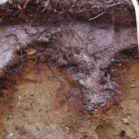
Orthic humoferric podzol at J.D. Irving, Black Brook. N.B. irregular Ae.
Weak Ferric Profile
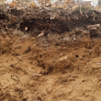
Weak ferric profile in sandy loam till Algonquin Park, under hemlock.